Landslides are among the natural hazards that receive less attention than they deserve, because they are local and often follow other events. On 10 September, the US Geological Survey announced science funding for landslide risk reduction and preparedness work. The funding supports research and local efforts that can improve hazard understanding, mapping and preparedness, and it does not make landslides predictable in every location.
That distinction is important for how the announcement should be read.
What landslides depend on
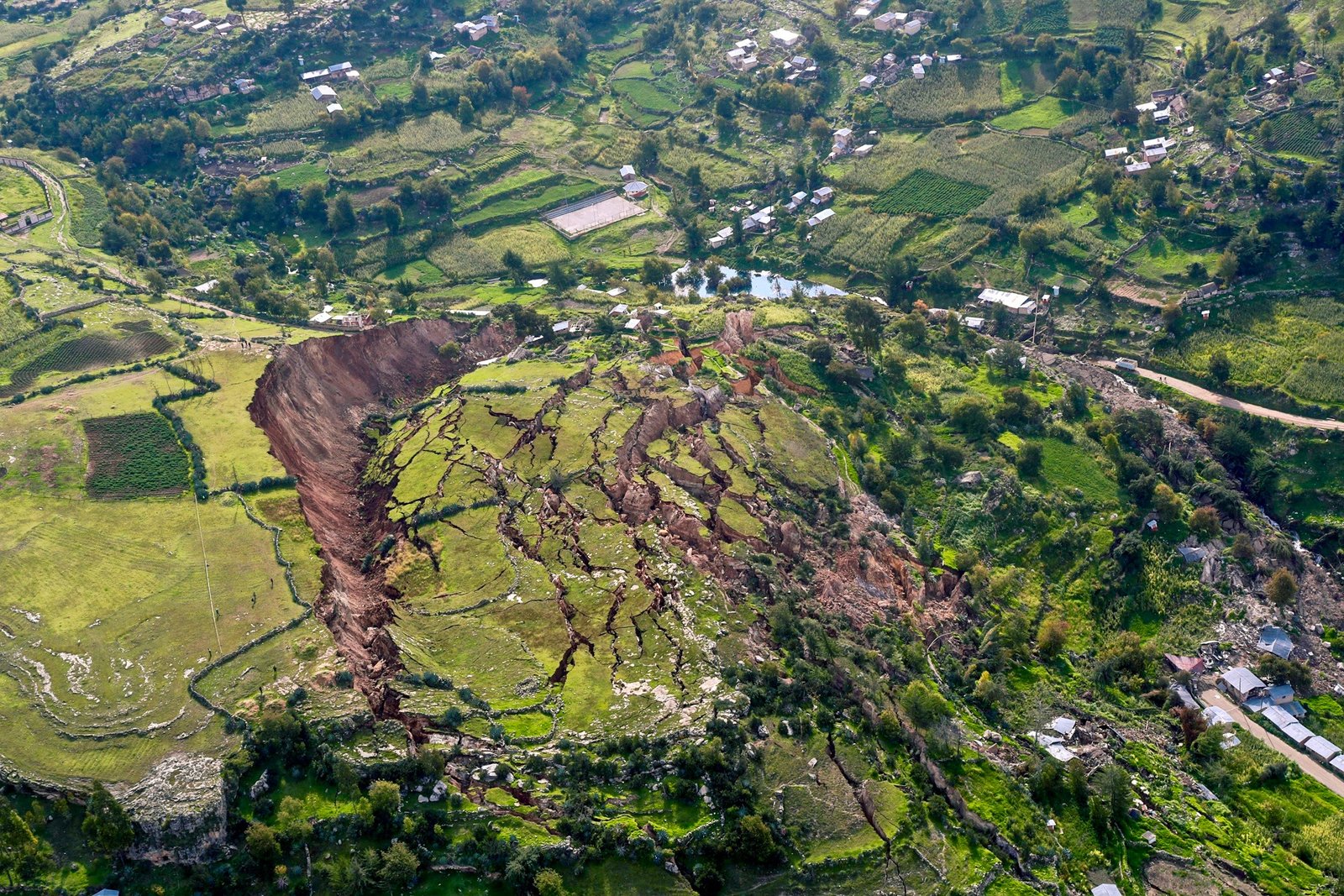
A landslide requires a slope, a material and a trigger. The trigger is often rainfall, and it can also be an earthquake, construction or the removal of vegetation. Because these factors vary from place to place, hazard assessment is inherently local. A national map can indicate where landslides are likely, and it cannot say when a particular slope will fail.
Why mapping matters
Hazard maps identify areas where landslides are more likely, which informs land-use planning, construction standards and emergency planning. The value of mapping depends on resolution and on whether the maps are used in decisions. A map that exists and does not influence permits or zoning has limited effect, which is why the local component of the funding matters.
The role of rainfall data
Rainfall thresholds are a common tool for landslide warning: when accumulated rain exceeds a level associated with past failures, warnings are issued. Thresholds depend on local geology and history, and they require monitoring networks and historical records. Where those are absent, warnings are less reliable, which is a gap the funding may help address.
Warning systems only work if people receive and act on them. Preparedness involves communication, evacuation planning and local knowledge of which slopes are dangerous. Communities that have experienced landslides often hold detailed knowledge that formal records lack, and incorporating it improves both mapping and response.
Where the evidence stops
The release does not establish outcomes for individual projects before research is completed. It announces funding and direction. The public benefit will appear in grant details, datasets and local hazard products, and those take time to produce.
Why landslide funding is often deferred
Landslides rarely cause the mass casualties of earthquakes or floods, which makes them less visible to donors and politicians. Their impacts are concentrated on particular communities, and they are often compounded by poverty and poor housing. The result is chronic underinvestment in a hazard that is largely preventable through planning and early warning.
Grant details, datasets and local hazard products will show public benefit. The questions worth following are whether mapping reaches the communities most at risk, whether warning systems are implemented and whether the research informs decisions about land use. Those are the pathways from funding to safety.
The insurance gap
Landslide risk is often uninsured, which means households bear the full loss when a slope fails. Insurance may be unavailable or unaffordable in high-risk areas, and where it exists, it can create incentives to build in dangerous locations. Closing the gap involves land-use rules as much as insurance markets, and the two are connected.
How warnings reach people
A warning is only useful if it arrives in time and in a form people can act on. Systems range from sirens and text alerts to community volunteers and radio. The most effective approaches combine several channels and are tested before they are needed. Communities that have rehearsed an evacuation respond differently from those encountering a warning for the first time.
Land-use decisions, building permits and emergency plans are made locally, which means landslide risk reduction depends on local capacity. Many small municipalities lack the technical staff to interpret hazard maps or enforce standards. Technical assistance and shared services are ways to address that gap, and they are less visible than funding for research.

The role of research
Landslide research spans geology, hydrology, engineering and social science, because the risk involves physical processes and human decisions. Funding that supports only one discipline tends to produce partial answers. The USGS programme’s combination of research and local work reflects an awareness that understanding the hazard is not enough without understanding how people respond to it.
Why hazard funding follows disasters
Funding for landslide research and preparedness often increases after a deadly event and fades as attention moves on. This cycle is common across natural hazards, and it produces investment that is reactive rather than sustained. The USGS programme is a modest exception in that it funds ongoing work, and its effectiveness will depend on whether the funding is maintained beyond the current cycle.
Communities at risk need more than maps and warnings. They need building standards that are enforced, land-use rules that keep development off dangerous slopes, and financial support for households that cannot afford to move. These are governance and equity questions, and they are often harder to address than the technical work of mapping.
This report draws on US Geological Survey.
Image: CaseGrillot · CC0 · via Wikimedia Commons.